
The Pennine Way: An Iconic Long-Distance Walking Trail
Introduction to the Pennine Way
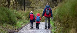
The Pennine Way is one of Britain's most iconic and challenging long-distance walking trails. Stretching for 268 miles (429 km) from Edale in the Peak District to Kirk Yetholm just across the Scottish border, this remarkable route takes hikers through some of the most stunning and remote landscapes in England, including the Yorkshire Dales, North Pennines, and Northumberland National Park. The Pennine Way offers an unforgettable adventure for experienced walkers seeking to immerse themselves in the wild beauty and rich history of the North.
The idea for the Pennine Way was first proposed by journalist and rambler Tom Stephenson in 1935. However, it wasn't until 1965, after decades of campaigning and negotiations with landowners, that the route was finally opened as Britain's first officially designated long-distance footpath. Since then, thousands of walkers each year have taken on the challenge of completing the Pennine Way route, typically taking between 2-3 weeks to walk the entire trail.
While the Pennine Way is undoubtedly a strenuous undertaking, with many steep ascents and descents, boggy sections, and exposed moorlands to traverse, it rewards those who embark on it with an unparalleled walking experience. The trail passes through three National Parks, numerous Nature Reserves and Sites of Special Scientific Interest, showcasing the diverse landscapes and ecosystems of the Pennines. Walking the Pennine Way is not just a physical challenge, but also a journey through history, with the trail passing ancient stone circles, Roman roads, medieval castles, and industrial relics that tell the story of the region's rich cultural heritage.
The Significance of the Pennine Way
The Pennine Way holds a special place in the hearts of long-distance walkers and outdoor enthusiasts in Britain and beyond. As the country's first official long-distance footpath, it paved the way for the establishment of the 15 other National Trails that now crisscross England, Scotland, and Wales. The creation of the Pennine Way was a landmark moment in the history of public access to the countryside, representing a hard-fought victory for the "right to roam" movement and a recognition of the importance of outdoor recreation for physical and mental wellbeing.
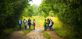
Today, the Pennine Way walk remains one of the most popular and iconic long-distance trails in Britain, attracting walkers from all over the world. The sense of achievement and camaraderie that comes with completing the route is unparalleled, with many walkers forming lifelong friendships and memories along the way. The Pennine Way has also inspired countless artists, writers, and photographers, who have captured the beauty and majesty of the Pennine landscapes in their work.
But the significance of the Pennine Way goes beyond its recreational and cultural value. The trail plays a vital role in the conservation and protection of the Pennine environments, by promoting sustainable tourism and raising awareness of the importance of preserving these fragile landscapes for future generations. The Pennine Way Association, a volunteer-led organisation, works tirelessly to maintain and improve the trail, and to educate walkers about the principles of responsible and low-impact hiking.
In many ways, the Pennine Way route represents the very best of what Britain's countryside has to offer - stunning natural beauty, rich cultural heritage, and a spirit of adventure and exploration. Whether you are a seasoned long-distance walker or a newcomer to the joys of multi-day hiking, the Pennine Way offers an unforgettable experience that will stay with you for a lifetime.

Navigating the Route: Maps and Path-Finding on the Pennine Way
The Importance of Careful Navigation
Successfully navigating the Pennine Way route requires careful planning, preparation, and attention to detail. While the trail is generally well-signposted, with the familiar acorn symbol used to mark the route, there are sections where the path becomes less distinct, particularly in the more remote and mountainous areas. Poor weather conditions, such as heavy fog or rain, can also make navigation more challenging, even for experienced walkers.
The consequences of getting lost on the Pennine Way can be serious, particularly in the more remote and exposed sections of the trail. The Pennine uplands are known for their changeable and unpredictable weather, with the potential for hypothermia, exhaustion, and injury if walkers are not properly equipped or prepared. In some areas, particularly in the North Pennines and Cheviots, the trail passes through remote and uninhabited landscapes, with limited access to shelter, water, or emergency services.
To navigate the Pennine Way safely and effectively, walkers should equip themselves with reliable maps, a compass, and the skills to use them. The official Pennine Way maps, produced by Harvey Maps in partnership with the Ordnance Survey, provide detailed 1:40,000 scale coverage of the entire route, divided into two maps - one for the northern section and one for the southern. These maps are waterproof and tear-resistant, making them ideal for use in the field.
In addition to maps, walkers should also carry a reliable compass and know how to use it to orient themselves and navigate in poor visibility. GPS devices and smartphone apps can also be useful tools for navigation, but should not be relied upon exclusively, as battery life and signal strength can be limited in remote areas. Walkers should also familiarise themselves with key landmarks and features along the route, such as distinctive hills, rivers, and settlements, which can aid navigation and provide reassurance in uncertain situations.
Navigation Skills and Techniques
Developing good map-reading and navigation skills is essential for anyone attempting the Pennine Way walk. The ability to orient a map using a compass, interpret contour lines and other symbols, and identify key features in the landscape can make the difference between a safe and enjoyable hike and a potentially dangerous situation.
One of the most important navigation skills for Pennine Way walkers is the ability to take a bearing using a map and compass. This involves identifying a visible landmark on the map, aligning the compass with the map's north-south axis, and then using the compass to determine the direction of travel required to reach the landmark. This technique can be particularly useful in poor visibility or when the path is unclear.
Another important skill is the ability to estimate distance and time based on the map and the terrain. The Pennine Way maps use a 1:40,000 scale, which means that one centimetre on the map represents 400 metres on the ground. By measuring the distance between two points on the map using a ruler or the compass edge, and then calculating the time required to cover that distance based on the terrain and the walker's pace, it is possible to plan a safe and achievable itinerary for each day's walk.
Walkers should also be aware of the potential for magnetic interference when using a compass, particularly in areas with high concentrations of iron ore or other magnetic minerals. The Pennine Way passes through several areas with a history of mining and quarrying, where magnetic anomalies can cause the compass needle to deviate from true north. In these situations, walkers should rely on other navigation aids, such as maps and visible landmarks, to confirm their position and direction of travel.
Ultimately, the key to successful navigation on the Pennine Way is a combination of careful planning, attention to detail, and a willingness to adapt to changing circumstances. By equipping themselves with the right tools and skills, and by approaching the trail with a sense of caution and respect for the natural environment, walkers can safely and confidently navigate this iconic route, and enjoy all the rewards and challenges it has to offer.

Getting There: Starting Points and Transportation Links for the Pennine Way
The Northern Terminus: Kirk Yetholm
The Pennine Way officially ends in the village of Kirk Yetholm, just across the border in the Scottish Borders. This picturesque village, with its traditional stone houses and friendly pubs, marks the northern terminus of the trail and is a popular destination for walkers completing the route from south to north.
Despite its remote location, Kirk Yetholm is relatively well-connected by public transportation. The nearest railway station is at Berwick-upon-Tweed, which has regular services from Edinburgh and Newcastle. From there, the 67 bus runs to Kirk Yetholm, though services are infrequent, so it's essential to check timetables in advance. Alternatively, many walkers opt to take a taxi from Berwick-upon-Tweed or the nearby town of Kelso, which offers a wider range of accommodation and services.
For those driving to Kirk Yetholm, there is a small car park in the village where it is possible to leave a vehicle for the duration of the walk. However, as the Pennine Way route is linear rather than circular, walkers will need to arrange transportation back to their starting point at the end of the trail. Many choose to use baggage transfer services, which can also provide car relocation, to avoid having to make separate arrangements.
The Southern Terminus: Edale
The start of the Pennine Way is in the village of Edale in the Peak District National Park. This small but bustling village is a popular hub for walkers and outdoor enthusiasts, with a range of accommodation, shops, and services catering to their needs.
Edale has its own railway station on the Manchester to Sheffield line, with direct trains running from Manchester Piccadilly station to Edale roughly every hour. The journey takes around 40 minutes, making it a convenient option for those traveling from the city. For walkers coming from further afield, Manchester Airport is a major international hub with excellent onward rail connections to Edale.
For those driving to Edale, there is a large pay-and-display car park in the village, as well as a number of smaller parking areas nearby. However, as with Kirk Yetholm, walkers will need to arrange transportation back to Edale at the end of the trail if they plan to leave their vehicle there.
Other Access Points and Public Transportation
In addition to the northern and southern termini, there are numerous other access points along the Pennine Way with good public transportation links. These include:
- Hebden Bridge, West Yorkshire - served by regular trains from Leeds and Manchester
- Malham, North Yorkshire - served by buses from Skipton and Settle
- Horton-in-Ribblesdale, North Yorkshire - served by trains on the Settle-Carlisle line
- Middleton-in-Teesdale, County Durham - served by buses from Barnard Castle and Durham
- Alston, Cumbria - served by buses from Carlisle, Hexham, and Penrith
- Greenhead, Northumberland - served by trains on the Tyne Valley line and buses from Carlisle and Hexham
While public transportation links to these access points are generally good, it's worth noting that bus services in particular can be limited, especially on weekends and holidays. Careful planning and attention to timetables are therefore essential for those relying on public transport to access the trail.
For those planning to walk the Pennine Way in sections, rather than in a single continuous journey, these access points can serve as convenient starting and ending points for each stage. By using public transport to travel between the trail and nearby towns and cities, walkers can avoid the need for complicated car shuttles or expensive taxi transfers, and can enjoy the flexibility and freedom of a self-supported hike.


Eating and Sleeping: Accommodation and Food Options Along the Pennine Way
Accommodation Options
One of the great advantages of walking the Pennine Way is the variety of accommodation options available along the route. From cosy bed and breakfasts to remote bunkhouses and campsites, there is something to suit every budget and preference.
The most common type of accommodation on the Pennine Way is the traditional bed and breakfast or guesthouse. These can be found in most of the villages and towns along the route, and offer a comfortable bed for the night, often with a hearty cooked breakfast included. Prices for B&Bs vary depending on the location and facilities, but typically range from £40 to £80 per person per night.
For those on a tighter budget, there are also a number of youth hostels and bunkhouses along the trail. These offer dormitory-style accommodation and self-catering facilities, with prices typically ranging from £15 to £30 per person per night. Some notable hostels on the Pennine Way route include the YHA hostels at Edale, Malham, and Once Brewed, as well as independent hostels like the Langdon Beck Hotel in Teesdale and the Greenhope Centre in the Cheviots.
Camping on the Pennine Way is another popular option, particularly for those looking to immerse themselves in the natural beauty of the trail. There are campsites on the Pennine Way at regular intervals, ranging from basic wild camping spots to more developed sites with showers, kitchens, and even pubs. Prices for campsites are typically around £5 to £10 per person per night, depending on the facilities available.
In some of the more remote sections of the trail, particularly in the North Pennines and Cheviots, accommodation options may be more limited. In these areas, walkers may need to rely on remote bunkhouses, bothies, or wild camping to shelter for the night. It's essential to plan ahead and carry appropriate equipment, such as a tent, sleeping bag, and stove, to ensure a safe and comfortable experience in these more isolated stretches.
Food and Resupply Points
When it comes to food and drink, the Pennine Way offers plenty of opportunities for walkers to refuel and resupply along the route. Most of the villages and towns along the trail have at least one pub, cafe, or shop where it is possible to buy meals, snacks, and groceries.
In the larger settlements, such as Edale, Hebden Bridge, and Alston, there are also supermarkets and outdoor gear shops where walkers can stock up on supplies for the trail ahead. Many B&Bs and guesthouses will also provide packed lunches for walkers, or may offer evening meals by arrangement.
In the more remote sections of the trail, particularly in the North Pennines and Cheviots, resupply points may be more limited. Walkers should plan ahead and carry enough food and water to last them through to the next town or village, which may be a day or more away. Dehydrated meals and high-energy snacks like nuts, dried fruit, and chocolate are ideal for these stretches, as they are lightweight and easy to prepare with minimal equipment.
It's also worth noting that some accommodation providers along the route may offer baggage transfer services, which can be a convenient way to resupply without having to carry a heavy load. These services typically charge a fee per bag and can be arranged in advance through the Pennine Way Association or individual providers.
Ultimately, the Pennine Way walk offers a wide range of accommodation and food options to suit every budget and preference. Whether you prefer the comfort of a B&B or the adventure of wild camping, there are plenty of opportunities to rest, refuel, and recharge along the route. By planning ahead, making use of the resources available, and being flexible in your approach, you can ensure a safe, comfortable, and enjoyable journey along this iconic trail.

Highlights and Heritage: Landmarks and History Along the Pennine Way
Ancient Landmarks and Historical Sites
The Pennine Way passes through some of the most historically significant landscapes in Britain, with a wealth of ancient landmarks and archaeological sites to discover along the route. From prehistoric stone circles to Roman forts and medieval castles, the trail offers a fascinating glimpse into the rich cultural heritage of the Pennines.
One of the most iconic ancient landmarks on the Pennine Way route is the mysterious stone circle known as the Nine Standards Rigg, located high on the moors above Kirkby Stephen in Cumbria. The origin and purpose of these nine tall stone cairns, which date back to the Bronze Age, remains unknown, but they are thought to have served as boundary markers or ritual sites for ancient communities.
Another notable historical site along the trail is the Roman fort of Hardknott, located in the remote Eskdale valley in the Lake District. Built in the 2nd century AD to guard a key strategic road through the Pennines, the fort offers a fascinating glimpse into the military history of the region, with well-preserved remains of barracks, bathhouses, and a parade ground.
The Pennine Way also passes through several important medieval sites, including the magnificent Rievaulx Abbey in North Yorkshire, one of the largest and most powerful Cistercian monasteries in England. Founded in 1132, the abbey played a key role in the religious and economic life of the region for over 400 years, before being dissolved by Henry VIII in 1538.
Industrial Heritage and Mining History
In addition to its ancient and medieval history, the Pennine Way also offers a fascinating glimpse into the industrial heritage of the Pennines. The trail passes through several areas with a rich mining and quarrying history, from the lead mines of the North Pennines to the coal pits of the South Pennines.
One of the most significant industrial sites along the route is the Killhope Lead Mining Museum in County Durham. Located in the heart of the North Pennines Area of Outstanding Natural Beauty, the museum offers visitors the chance to explore the remains of a 19th-century lead mine, complete with restored machinery, underground tunnels, and a working waterwheel.
Another important industrial landmark on the Pennine Way walk is the Stoodley Pike monument, located on the moors above Hebden Bridge in West Yorkshire. The monument, which stands over 120 feet tall, was built in 1856 to commemorate the end of the Crimean War and serves as a striking reminder of the region's proud industrial and military heritage.
The South Pennines, in particular, are home to a rich coal mining history, with many former pit villages and mining towns located along the Pennine Way route. The trail passes through several important mining heritage sites, including the National Coal Mining Museum for England near Wakefield, which offers visitors the chance to explore the underground workings of a former colliery and learn about the lives of the miners who worked there.
While many of these industrial sites have long since closed, their legacy lives on in the landscapes and communities of the Pennines. By exploring these important landmarks and learning about the region's rich industrial heritage, walkers on the Pennine Way can gain a deeper appreciation for the challenges and opportunities that have shaped this unique and fascinating part of Britain.

Wildlife and Nature: Flora and Fauna of the Pennine Way
Diverse Habitats and Ecosystems
The Pennine Way passes through a remarkable diversity of habitats and ecosystems, each with its own unique flora and fauna. From the heather moorlands of the Peak District to the limestone pavements of the Yorkshire Dales, the trail offers endless opportunities for nature lovers to discover the rich biodiversity of the Pennines.
One of the most iconic habitats along the Pennine Way route is the blanket bog, a rare and fragile ecosystem characterised by deep layers of peat and specialised plant communities. The trail passes through several important blanket bog sites, including the Moor House-Upper Teesdale National Nature Reserve in the North Pennines, which is home to a unique assemblage of arctic-alpine plants, such as the rare spring gentian and bird's-eye primrose.
Another important habitat along the trail is the limestone pavement, a distinctive landform created by the erosion of limestone bedrock. The Yorkshire Dales are particularly renowned for their extensive limestone pavements, which support a rich diversity of wildflowers and ferns, including the rare rigid buckler fern and baneberry.
The Pennine Way also passes through several important woodland habitats, from the ancient oak woods of the Peak District to the conifer plantations of Northumberland. These woodlands are home to a wide variety of bird and mammal species, including the elusive pine marten, the charming red squirrel, and the majestic goshawk.
Iconic Wildlife Species
In addition to its diverse habitats, the Pennine Way walk is also home to a remarkable array of iconic wildlife species, many of which are rare or endangered in other parts of Britain. From the soaring golden eagle to the elusive black grouse, the trail offers endless opportunities for wildlife enthusiasts to spot some of the country's most impressive and charismatic creatures.
One of the most iconic bird species associated with the Pennine Way is the curlew, a large, long-billed wading bird known for its evocative, bubbling call. The trail passes through several important breeding sites for curlews, including the North Pennines and the Yorkshire Dales, where the birds can be seen and heard throughout the spring and summer months.
Another important bird species along the trail is the merlin, a small but powerful falcon that hunts over the open moorlands of the Pennines. The Pennine Way passes through several key merlin breeding sites, including the Forest of Bowland in Lancashire and the North Pennines, where the birds can be seen perching on rocky outcrops or hunting low over the heather.
Mammal species are also well-represented along the Pennine Way route, with several iconic species to look out for. The trail passes through some of the last remaining strongholds of the red squirrel in England, particularly in the Yorkshire Dales and Northumberland, where the species has been successfully reintroduced in recent years.
Other notable mammal species along the trail include the otter, which can occasionally be spotted hunting in the rivers and streams of the Pennines, and the mountain hare, a specialist of the high moorlands that turns white in winter to blend in with the snow.
Of course, these are just a few examples of the many fascinating wildlife species that can be encountered along the Pennine Way. By keeping a keen eye and an open mind, walkers can discover a wealth of natural wonders along the route, from the smallest insects to the largest mammals. Whether you are a seasoned naturalist or a casual wildlife enthusiast, the Pennine Way offers an unparalleled opportunity to immerse yourself in the rich and varied natural heritage of the Pennines.

Terrain and Difficulty: Challenges and Fitness Requirements for Walking the Pennine Way
Varied Terrain and Challenging Conditions
One of the most significant challenges of walking the Pennine Way is the varied and often challenging terrain that the trail passes through. From the gentle rolling hills of the Peak District to the steep, rocky slopes of the North Pennines, the route encompasses a wide range of landscapes and walking conditions that can test even the most experienced hikers.
The southern sections of the Pennine Way route, particularly through the Peak District and Yorkshire Dales, are generally considered to be the gentlest and most accessible parts of the trail. Here, the terrain is characterised by well-maintained paths, grassy slopes, and relatively low elevations, with few steep or technical sections to navigate.
However, as the trail progresses northwards, the terrain becomes increasingly rugged and challenging. The North Pennines, in particular, are known for their remote and unforgiving landscapes, with long stretches of exposed moorland, deep peat bogs, and steep, rocky ascents and descents that can be difficult to navigate in poor weather conditions.
The Cheviots, at the northern end of the Pennine Way, present their own unique challenges, with high, windswept ridges, remote river valleys, and few man-made landmarks to aid navigation. The trail here is often indistinct and can be difficult to follow in low visibility, making good map and compass skills essential.
Throughout the route, walkers must also contend with the unpredictable and often harsh weather conditions of the Pennines. The region is known for its strong winds, heavy rain, and thick fog, which can make even simple navigational tasks difficult and potentially dangerous. Walkers must be prepared for all eventualities and carry appropriate clothing, equipment, and supplies to ensure a safe and enjoyable journey.
Physical Fitness and Preparation
Given the challenging nature of the terrain and the length of the Pennine Way walk, a good level of physical fitness and preparation is essential for anyone attempting the trail. While it is possible to complete the route in sections over a period of time, most walkers aim to complete the entire 268-mile journey in a single trip, typically taking between two and three weeks to do so.
To undertake such a challenge, walkers must be prepared to walk long distances day after day, often carrying a heavy pack and contending with difficult terrain and weather conditions. A typical day on the Pennine Way might involve walking 15-20 miles or more, with significant ascents and descents along the way.
To prepare for this level of physical exertion, it is essential to build up gradually over a period of time. Regular walking and hiking, particularly on varied terrain and in different weather conditions, can help to build the necessary stamina and resilience required for a long-distance trail like the Pennine Way.
Strength and conditioning exercises, such as squats, lunges, and step-ups, can also be beneficial in building the leg strength and stability needed for the steep and uneven terrain of the Pennines. Core exercises, such as planks and back extensions, can help to improve posture and reduce the risk of injury when carrying a heavy pack.
In addition to physical preparation, mental preparation is also key to a successful Pennine Way walk. The trail can be a lonely and isolating experience at times, with long stretches of remote and challenging terrain to navigate. Having a positive attitude, a sense of determination, and a willingness to embrace the challenges and discomforts of long-distance walking can make all the difference in completing the route.
Ultimately, walking the Pennine Way is a significant undertaking that requires careful planning, preparation, and a realistic assessment of one's own abilities and limitations. By taking the time to build up gradually, investing in appropriate gear and equipment, and cultivating a positive and resilient mindset, walkers can rise to the challenges of this iconic trail and enjoy the many rewards and satisfactions that it has to offer.

Seasons and Weather: When to Walk the Pennine Way
Seasonal Variations and Weather Patterns
The experience of walking the Pennine Way can vary greatly depending on the time of year and the prevailing weather conditions. Each season brings its own unique challenges and rewards, from the lush green landscapes of spring to the harsh and unforgiving conditions of winter.
Spring (March to May) is a popular time to walk the Pennine Way, with the promise of longer days, warmer temperatures, and the first signs of new life emerging in the landscape. The heather moorlands of the Pennines are particularly beautiful in spring, with the delicate pink and purple flowers of the heather creating a stunning carpet of colour across the hills.
However, spring weather in the Pennines can also be highly unpredictable, with the potential for sudden cold snaps, heavy rain, and even snow well into April. Walkers must be prepared for a wide range of conditions and carry appropriate clothing and equipment to ensure a safe and comfortable journey.
Summer (June to August) is generally considered the best time to walk the Pennine Way, with warmer temperatures, longer days, and generally more settled weather patterns. The landscapes of the Pennines are at their most lush and vibrant in summer, with wildflowers blooming in the meadows and birds and insects filling the air with sound.
However, summer can also bring its own challenges, particularly in the form of midges and other biting insects. These tiny flies can be a major nuisance in some parts of the Pennines, particularly in the early morning and evening when the air is still. Walkers should carry insect repellent and consider using a head net to protect against bites.
Autumn (September to November) can be a beautiful time to walk the Pennine Way route, with the changing colours of the landscape creating a stunning backdrop to the journey. The heather moorlands turn a deep purple in September, while the woodlands of the Yorkshire Dales and Northumberland are ablaze with the golds and reds of turning leaves.
However, autumn weather in the Pennines can also be highly changeable, with the potential for strong winds, heavy rain, and even snow in the higher elevations. Walkers must be prepared for shorter days and colder temperatures, particularly in the northern sections of the trail.
Winter (December to February) is generally considered the most challenging time to walk the Pennine Way, with short days, cold temperatures, and the potential for snow and ice in the higher elevations. While some sections of the trail, particularly in the Peak District and Yorkshire Dales, may still be accessible in winter, the northern sections of the route are often impassable due to deep snow and dangerous conditions.
However, for experienced and well-equipped walkers, a winter journey on the Pennine Way can be a truly unforgettable experience, with the stark beauty of the snow-covered landscapes and the sense of solitude and isolation that comes with having the trail largely to oneself.
Ultimately, the best time to walk the Pennine Way will depend on a range of factors, including personal preference, level of experience, and tolerance for different weather conditions. By carefully considering the seasonal variations and weather patterns of the Pennines, and by being prepared for a wide range of conditions, walkers can choose the best time to undertake this iconic journey and enjoy all the rewards and challenges that it has to offer.

Completing the Pennine Way
Reflections on the Journey
Completing the Pennine Way is an accomplishment that will stay with you for a lifetime. Whether you have walked the entire 268-mile route in one go or completed it in sections over a period of time, the sense of achievement and satisfaction that comes with reaching Kirk Yetholm and crossing the finish line is truly unparalleled.
Looking back on the journey, it is impossible not to be struck by the sheer diversity and beauty of the landscapes that the Pennine Way walk passes through. From the gentle hills and valleys of the Peak District to the wild and remote moorlands of the North Pennines, the trail offers a stunning showcase of the natural and cultural heritage of northern England.
Along the way, walkers will have encountered countless challenges and obstacles, from steep and rocky ascents to deep and treacherous bogs, from wind and rain to sun and heat. They will have pushed themselves to their physical and mental limits, testing their endurance, resilience, and determination in the face of adversity.
But they will also have experienced moments of pure joy and exhilaration, from the thrill of reaching a hard-earned summit to the simple pleasure of a hot meal and a comfortable bed at the end of a long day. They will have forged friendships with fellow walkers, sharing stories and experiences around campfires and in pubs along the way.
And they will have gained a new appreciation for the rich and varied history and culture of the Pennines, from the ancient stone circles and Roman forts to the industrial heritage of the mining towns and villages. The Pennine Way route is not just a walking trail, but a journey through time and a testament to the enduring spirit of the people who have shaped this land over the centuries.
Looking to the Future
Completing the Pennine Way is not the end of the journey, but the beginning of a new chapter. For many walkers, the experience of hiking this iconic trail sparks a lifelong love of long-distance walking and a desire to explore new and challenging routes both in the UK and beyond.
The sense of accomplishment and confidence that comes with completing a trail like the Pennine Way can also translate into other areas of life, from work and relationships to personal growth and development. The skills and qualities that are honed on the trail - resilience, adaptability, self-reliance, and a positive attitude - are invaluable assets in navigating the challenges and opportunities of everyday life.
For those who have completed the Pennine Way walk, there are countless other long-distance trails and walking routes to explore in the UK and beyond. The Coast to Coast, the West Highland Way, and the Camino de Santiago are just a few examples of the many iconic trails that offer their own unique challenges and rewards.
But even for those who never walk another long-distance trail, the memories and experiences of the Pennine Way will always hold a special place in their hearts. The friendships forged on the trail, the moments of triumph and adversity, and the deep sense of connection to the land and its people will stay with them for a lifetime.
Related Articles
Let us know you agree to cookies
We use marketing, analytical and functional cookies as well as similar technologies to give you the best experience. Third parties, including social media platforms, often place tracking cookies on our site to show you personalised adverts outside of our website.
We store your cookie preferences for two years and you can edit your preferences via ‘manage cookies’ or through the cookie policy at the bottom of every page. For more information, please see our cookie policy.